Application Purpose
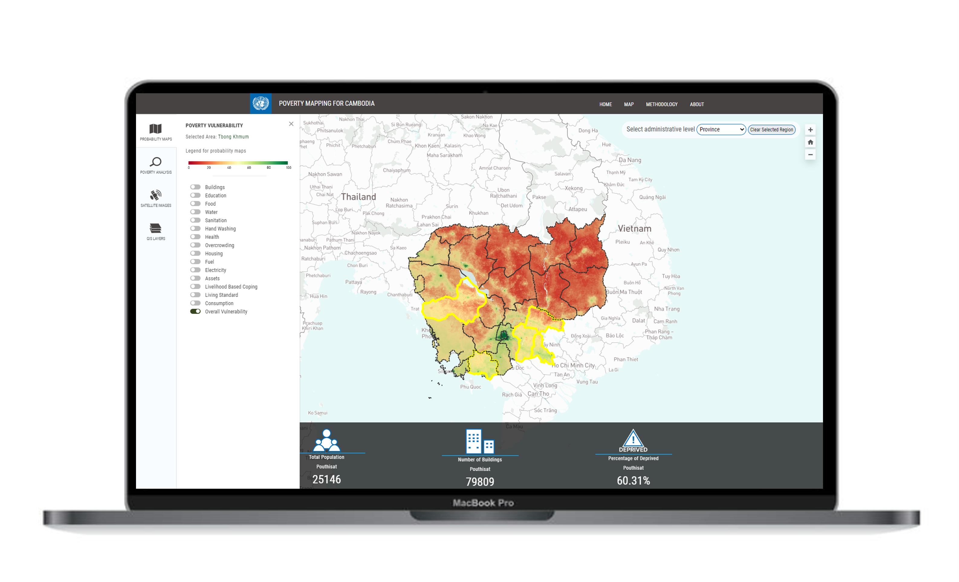
Artificial intelligence can be very useful to map vulnerability across different dimensions in space and time at the household level. The poverty mapping tool can provide valuable insights into the location and extent of different deprivations across Cambodia and help achieve different Sustainable Development Goals.
Application Uses
The poverty mapping tool is currently used by the National Institute of Statistics with technical and financial support from UNDP Cambodia to track deprivations and report on vulnerability across the country.
Easily Accessible
The system uses free, easily accessible, open source data and is fully customizable to meet user-tailored needs
Artificial Intelligence
The system uses the newest methodologies in the field of Machine Learning and Artificial Intelligence.
Cloud Technology
Use of the latest cloud computing technologies, leveraging the power of Google Earth Engine cloud-based platform.
Our Partners


Disclaimer: The results presented on this website are the outcome of an exploratory scientific study on the use of AI for vulnerability mapping in Cambodia. Results should be interpreted in this context and not be used as absolute or official numbers endorsed by official entities. For more information please contact UNDP Cambodia.
